Hiking area
„most instagramable spots“ on Loser Altaussee
With its snow-covered winter landscape and its many ski slopes, the Salzkammergut area has always been popular with photographers.
There are nearly 200,000 posts on social media under the hashtag #salzkammergut.
Whether you are a professional photographer or amateur, we will show you the Loser’s best Instagram spots and give you some insider.
Loser Bergbahnen on Instagram
#1 loserlaunch
Name | #loserlaunch |
Hashtags | #loserlaunch #loserbergbahnen #losermountain |
Best time? | #sunrise #sun #allyear |
Where to find? |
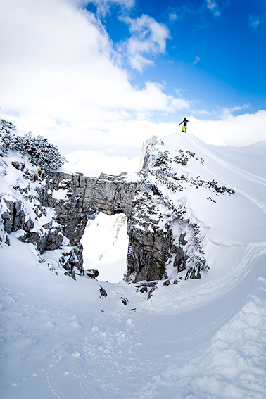
#2 loserfenster
Name | #loserfenster |
Hashtags | #loserfenster #loserbergbahnen #losermountain |
Best time? | #allday #allyear |
Where to find? |